The Surveyor General of the Federation – Nigeria is a man with lofty responsibilities cutting across many aspect of the country.
Apart from land surveying (also known as cadastral surveying), there are other types of surveying including, engineering, mining, hydrographic (bathymetric) and geodesy as well as aerial and topography surveying.
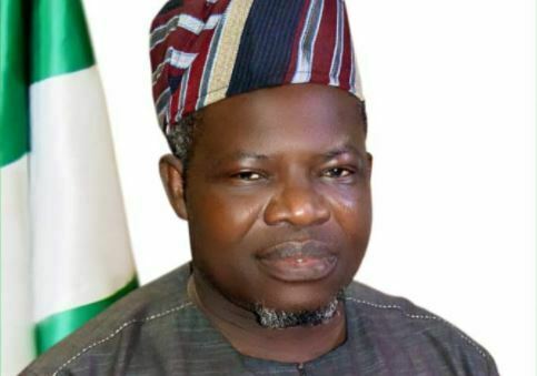
This makes the Surveyor General of the Federation a generalist, a position, Surveyor Abuduganiyu Adeyemi Adebomehin occupies.
In this interview, Adeyemi identified parts of Nigeria that are prone to earthquake.
According to him, the Office of the Surveyor General of the Federation (OSGF) is the office mandated to produce maps, hence his threat to arrest and prosecute people producing maps illegally in Nigeria.
He also condemned the indiscriminate drilling of boreholes in Nigeria, warning that the nation is postponing the evil days.
As for the frequent building collapse in Nigeria, he blames all the professionals in the built industry for complicity. Excerpts
Is Nigeria prone to earthquake?
Nigeria remains one of the luckiest nations in the world considering that natural disaster like earthquakes rarely occur in the country.
There is a committee called United Nations Geospatial Information Management Unit. They advise all member states to establish what we call Continuously Operating Reference Station (CORS). Before now, we used to have what we call controls and benchmark. Controls and benchmark are passive stations. They are passive in the sense that they are there even when we go to sleep. You’ll only need equipment to go back to know whether the position he is telling you is still the same thing. But because of development, the committee now says go and establish active stations. When we have our active station, it should be able to give us information 40 kilometers from where it’s stationed. The aim behind that is to be able to predict when there’s going to be an earthquake. What’s an earthquake – when the celestial bodies come in contact with themselves. There’s going to be a kind of two forces going in opposite directions. The ground cannot contain such a force. You need to look at a star under the telescope and you will see that the star can consume the whole earth. So, when these forces come in contact with each other, that force cannot be under the ground. They now find a way on top. So, that is another field in geodesy. We call it tectonic movement. The effects of that force is what comes on top.
Which areas are prone to earthquake in Nigeria?
We have had an earthquake in Kaduna before but they said it’s a mild earthquake. We had in Ijebu Ode. But we were allowed to tell people of what we saw then. I was the head of that team with my director then who came after my research. There was a mild earthquake there. But they said that there was no earthquake. The land only shook.

Borehole drilling
When the authorities leave their responsibilities we are only shifting the doomsday and that which you have just mentioned is a very serious issue. Disturbing the system on its own is dangerous. It’s not a system put in place by me or you. It’s a system put in place by God Almighty. And anytime we drill and we remove the resources, there’s need for us to fill it back with another substance (especially if the borehole fails). But when somebody drills a borehole and it fails, he will just go and drill another one. It’s an ecosystem on its own.
In an estate everybody drills a borehole instead of coming together to drill one. But because I don’t like you and you don’t like me and we don’t trust one another, boreholes are drilled indiscriminately. On its own, it will have a long time effect. It’s a study on its own because by and large we distort the nature on its own.
As adviser of the Federal Government, what’s the way out of indiscriminate drilling of boreholes?
Well, it falls under the purview of another Ministry, Department and Agency (MDA). There’s a department in agriculture and water resources ministry that is in charge of it.
They have a department called hydro and hydro-dynamics (H and H). That department looks into what is happening under the earth’s surface. Any time they stop any natural ecosystem there’s going to be consequences
What is your collaboration with National Boundary Commission?
National Boundary Commission used to be part of this office.
It seems you have conflicting roles now?
No. We don’t have conflicting roles. When people see it from outside they will say we have conflicting roles. We don’t have conflicting roles. When you look at a system that works outside the country you are always advised by the United Nations to adopt that system. The National Boundary Commission used to be part of this office but they are basically in charge of history which we call adjudication. Look at the history of that boundary and from the history of that boundary tell us what we need to know and what we don’t need to know. How does the line run from one place to the other which we call history of the boundary and that is adjudication. But there was a time they were lucky and they had a lot of funds. Then they employed a few surveyors. What we are saying is that there’s no conflict of roles there.
Do they survey?
They don’t survey. Anytime they are through with what they are doing, they will bring it before this office. It is now time for us to go for delineation, delimitation and demarcation (3Ds). And when they do that it’s the representative of the Surveyor General of the Federation that will sign on that map. That becomes a legal tender. It’s only of late that if we go out together and they bring in somebody who is a surveyor as part of that team. If I sign the document, that person can sign and all the surveyors in Nigeria are under the Surveyor General of the Federation. They’re pool officers. So, there’s no conflict of roles.
Here we have 14 technical departments. In National Boundary Commission they don’t have hydrographic department. It’s only the Surveyor General of the Federation that can define that entity called Nigeria. The National Boundary Commission cannot produce map of Nigeria. But when we go out to work they will do the history and we’ll put in bicorns that define that pole.
The Vice President is the chairman and the deputy governors of the states are in charge of boundaries.
The real owners of the boundaries are the indigenes and they will be invited and they will talk on camera.
Relationship with National Emergency Management Agency (NEMA)?
We have two or three of our officers as the members of their board because they use maps a lot and we have to define the entity called Nigeria. Again, we are in charge of research and rescue. When there’s a disaster we need to put up evacuation. When there’s a disaster nothing is normal again. The road to that place is not normal. They need a helicopter to go there. There’s a committee on research and rescue made up of surveyors and officers from other departments. Some will provide relief materials and other things but the main people that will go for evacuation are the surveyors.
Source: The Sun